Corral (Chile)
Coordinates: 39 ° 52 ′ S , 73 ° 27 ′ W
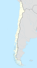
Corral is a city in the south of the South American Andean state of Chile and is located in the Región de los Ríos about 15 kilometers west of Valdivia directly on the Pacific Ocean . In 2005 it had 5300 inhabitants.
history
The city was founded in 1547, then under the name Santa María la Blanca de Valdivia . The area around Corral was developed into a heavily fortified bay. In total, the Spaniards built 17 forts around Corral and Valdivia. The area was subject to frequent attacks by English pirates . The important fortresses were Castillo San Sebastían de Corral , Castillo de la Pura y Limpia Concepción de Manfort de Lemus (Fuerte Niebla) and Castillo San Pedro de Alcántara on the island of Mancera.
On February 3rd and 4th, 1820 there was a battle between the Spaniards and the Chileans. After Chilean independence in 1818, the area was still partially occupied by Spain.
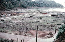
On May 22nd, 1960 Corral was hit by the strongest earthquake ever recorded in the world, the Great Chile Earthquake . It had a magnitude of 9.5 on the Richter scale . Corral was flooded by a large tsunami .
geography
Corral is located at the mouth of the Río Valdivia south of Valdivia and the island of Mancera. The municipality of Los Lagos lies to the east and the municipality of La Unión to the south .
tourism
Tourism is one of the city's main sources of income. The main attraction is the Fort Castillo San Sebastían de Corral . The Río Valdivia and the coast with its many small islands are other tourist destinations. The eight hectare Huapi Island can be visited by boat.
Web links
- Official Website (Spanish)


