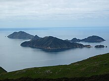
D'Urville Island (New Zealand)
| D'Urville Island | ||
|---|---|---|
| Aerial view | ||
| Waters | Marlborough Sounds ( South Pacific ) | |
| Geographical location | 40 ° 50 ′ S , 173 ° 52 ′ E | |
|
|
||
| length | 32.2 km | |
| width | 10.6 km | |
| surface | 150 km² | |
| Highest elevation | Attempt Hill (Maunga Wetekia) 729 m |
|
| Residents | 52 <1 inh / km² |
|
| main place | Owhata | |
D'Urville Island is an island in the Marlborough Sounds on the north coast of New Zealand's South Island . It is named after the French explorer Jules Dumont d'Urville and with an area of about 150 km² it is the eighth largest island in New Zealand. It has a permanent population of around 52. The main town is Owhata in the southwest. The island reaches its greatest height of 729 meters in Attempt Hill .
The name of the island in the Māori language is Rangitoto Ki Te Tonga , the local Māori tribes are the Ngāti Koata and Ngāti Kuia .
The Cook Strait , which separates the two main New Zealand islands, runs north of the island . The island is separated from the mainland by the dangerous French Pass (Māori: Te Aumiti ). When the tide changes, the water flows through the passage at up to 8 knots (14 km / h), then several vortices are created . D'Urville examined the passage for several days in 1827 and damaged his ship in the process. The French Pass Lighthouse was built on the passage in 1864 . The main tower is on the mainland, another on a reef that runs off the island.
Even before the arrival of the Europeans, the Māori used the island to mine minerals, especially the fine-grained sedimentary rock adzite , a particularly hard argillite that they used to make clubs and tools.
Large parts of the island are forested.
Smaller islands around D'Urville Island are:
- in the north: Stephens Island , Te Wakaapani , Te Mokaipani , Nga Tamahineapani , Victory Island
- in the southeast: Steward Island , Anatakupu Island , Penguin Island
- in the northeast: Wakaterapapanui Island , Puangiangi Island , Tinui Island
- in the south: Hautai Island
- to the west: Puotewheke , Tu Araiawa Island , Rahuinui Island , Hapuka Island , Cone Island
Individual evidence
- ↑ Gerard Hindmarsh: Discovering D'Urville . Heritage New Zealand. 2006. Retrieved January 13, 2011.
- ^ Map of D'Urville Island . (PDF (816 kB)) Geographx , archived from the original on June 5, 2010 ; accessed on August 10, 2014 (English, original website no longer available).


