French Pass Lighthouse
| French Pass Lighthouse | ||
|---|---|---|
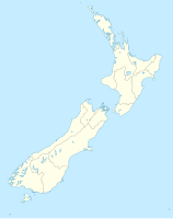
| Location: | French Pass, Marlborough Sounds , Marlborough District , South Island , New Zealand | |
| Geographical location: | 40 ° 55 '26.7 " S , 173 ° 50' 5.9" E | |
| Height of tower base: | 3 m | |
| Fire carrier height : | 3 m | |
|
|
||
| Identifier : | F WR / FW | |
| Scope knows: | 10 nm (18.5 km ) | |
| Scope red: | 7 nm (13 km ) | |
| Optics: | Drum lens | |
| Operating mode: | 1864 oil lamp 1961 acetylene burner 1967 electrification 1961 and 1971 automated |
|
| Function: | lighthouse | |
| Construction time: | 1864 | |
| Operating time: | since 1864 | |
| International ordinal number: | K4238 | |
French Pass Lighthouse is a lighthouse complex consisting of two separate beacons in the Marlborough Sounds in the Marlborough District . It stands at the French Pass , the passage between D'Urville Island and the north of the South Island of New Zealand . It is operated by Maritime New Zealand .
The French Pass connects Tasman Bay in the south with Pelorus Sound and the Cook Strait in the north. The navigable canal in the 500 m wide passage is only 100 m wide in places. This means that the passage is not without danger for ships. Already d'Urville's corvette Astrolabe got out of control in the passage on his second research expedition in 1827, hit the ground twice and was then washed over the reef into Admiralty Bay.
A stone beacon was erected on a reef that ran off D'Urville Island in the 1860s. In 1982 they were provided with a light because of the mail steamer that regularly runs at night between Nelson and Wellington. Despite the known risks, the French Pass Lighthouse was not built on the mainland south of the passage until two years later . Another small concrete tower was erected in the middle of the canal on a reef, its beacon was already supplied from a gas cylinder with acetylene with two to three months of gas supply. This tower was rammed by a steamer shortly afterwards and badly damaged.
The white iron lighthouse on the mainland went into operation on October 1, 1884, right on the bank of the canal. It is New Zealand's first iron lighthouse. In contrast to other lighthouses, the tower was not manned by several lighthouse keepers stationed on site. The lighthouse keeper lived nearby and if the beacon failed, he had to walk up a 100-step staircase to the tower or be transferred to the reef by a local family. When changing the gas bottle on the tower in the canal, the lighthouse keeper was supported by the crew of the supply ship for the lighthouses.
In 1952/1953 the tower on the mainland was also converted to an acetylene burner. In 1961 the tower on the mainland was also automated while maintaining the acetylene lighting. In 1967 the tower was electrified and supplied by a diesel generator, the lighthouse keeper was withdrawn. In 1971 it was connected to the national power grid with emergency power supply via accumulators. The main tower at that time had a 50 W halogen lamp. Since then, like all New Zealand lighthouses, it has been remotely controlled from a central control room at Maritime New Zealand's headquarters in Wellington .
The 3 meter high main tower is 3 meters above the sea, the 5 meter high tower on the reef at 5 meters. The main tower has a white and a red sector on both sides ( identifier F WR). As long as the ship is on the correct course, the white sector is visible; if you leave this sector, the red light is visible. The tower on the reef has a white identifier (identifier FW). The range of the red light is 13 km, that of the white light 18 km.
The towers are not open to the public.
Web links
- French Pass . Maritime New Zealand,accessed October 18, 2018.

