Waipapa Point Lighthouse
| Waipapa Point Lighthouse | ||
|---|---|---|
| Photo from 2006 before renovation | ||
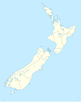
| Place: | Southland , South Island , New Zealand | |
| Location: | Southland , New Zealand | |
| Geographical location: | 46 ° 39 '36.2 " S , 168 ° 50' 49.4" E | |
| Height of tower base: | 21 m | |
| Fire carrier height : | 13 m | |
|
|
||
| Identifier : | FL (5) W 20s | |
| Scope knows: | 9 nm (16.7 km ) | |
| Operating mode: | Solar cells | |
| Function: | lighthouse | |
| Construction time: | 1884 | |
| Operating time: | since 1884 | |
The Waipapa Point Lighthouse is an operational lighthouse southwest of the Catlins on the south coast of New Zealand's South Island .
geography
The lighthouse is located 47 km southeast of Invercargill at the eastern end of Toetoes Bay on a hill at Waipapa Point , which protrudes into the Pacific Ocean here . The tower is accessible via a path from the small settlement of Otara on the New Zealand State Highway 92 , which is part of the Southern Scenic Route .
history
After the SS Tararua of the New Zealand Union Steam Ship Company ran onto the Otar Reef directly off the coast on April 29, 1881 , sank and took 131 people with them to their death, it was decided in future to use a beacon in front of the dangerous reef to warn. The wooden lighthouse was built in 1884. In 1975 the beacon was automated and in 1988 the energy supply switched to solar power. In December 2008 the lighthouse received LEDs for its beacon.
Cultural monument
The lighthouse was registered on June 26, 2009 together with the site of the shipwreck of the SS Tararua by the New Zealand Historic Places Trust under number 7785 as " Historic Place Category 1 ".

