East Cape Lighthouse
| East Cape Lighthouse | ||
|---|---|---|
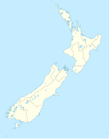
| Location: | At the end of the coastal road, on the 144 m high Otiki , East Cape , Gisborne , North Island , New Zealand | |
| Geographical location: | 37 ° 41 '20.4 " S , 178 ° 32' 53.3" O | |
| Height of tower base: | 144 m | |
| Fire carrier height : | 15th | |
|
|
||
| Identifier : | FL W 10s | |
| Scope knows: | 19 nm (35.2 km ) | |
| Operating mode: | rotating 50 watt tungsten halogen lamp | |
| Function: | Orientation fire | |
| Construction time: | 1900 (moved to the mainland in 1922) | |
| Operating time: | since 1900 | |
The East Cape Lighthouse is a lighthouse on the northeast tip of the North Island of New Zealand .
geography
The East Cape Lighthouse is located on the 144 m high Otiki , a secluded hill located directly on the coast of the East Cape . Further east, a distance of 2 km in the coast, there is only the approximately 13 hectare large island East Iceland .
The lighthouse can only be reached via a 20 km long coastal road, the East Cape Road, from Te Araroa . The small settlement has a connection to the New Zealand State Highway 35 in the west, which continues in the west to Opotiki and to the south in the direction of Gisborne .
history
The lighthouse was first installed in 1900 on the island of East Island off the mainland . But from the beginning, the construction and operation of the beacon was accompanied by difficulties and accidents. During the construction, a steamship that was supposed to bring material to the construction capsized and dragged four sailors with it to their deaths. Another problem arose a few years after the lighthouse was in operation. The island's cliffs gave way due to erosion and made the subsoil for the structure unstable. In the 1920s, the decision was finally made to move the lighthouse to the mainland. The relocation work began in April 1922 and was completed with the restart in December 1922.
The lighthouse was initially operated with a paraffin oil lamp, but in 1954 it was switched to a diesel-powered power supply. In 1971 it was connected to the country's power grid and the lighthouse keeper who had been working up until then - there were three in the past - was replaced in 1985 by fully automatic operation of the lighthouse. The last replacement of the beacon for a rotating 50 watt tungsten halogen lamp took place in February 2002.
Dates of the lighthouse
The tower consists of a cylindrical cast iron construction which, with the structure of the beacon, has a height of 15 m. The tower itself stands on a small plateau, which is the highest point of the Otiki and rises 144 m above sea level. The operation is now fully automatic electrically, whereby in the event of a power failure, accumulators can ensure the operation of the system for a time. With the built-in rotating 50 watt tungsten halogen lamp, a beacon with the identification Fl W 10s (a white flashing light every 10 seconds ) is sent over the sea with a range of 19 nautical miles (35 km).
The lighthouse is operated by Maritime New Zealand and controlled from Wellington .
Lighthouse Reserve
In June 2017 the Gisborne District Council designated a 70 hectare area around the lighthouse and towards the coast in order to be able to declare the area a protected area in a second step via the Tairāwhiti Management Plan . Trees such as Puriri and Tawa grow in the area and the scrubland consists of vegetation of New Zealand flax (Phormium cookanum) - narrow-leaved sticky seeds (Pittosporum tenuifolium) - South Sea myrtle , called Manuka and Kanuka (Kunzea ericoides). A special species of the plantain (Plantago picta) is considered an endangered species there.
tourism
The lighthouse is freely accessible from the outside of a car park and via a small hiking trail with around 700 steps. The tower itself cannot be climbed, but the old beacon, which was expanded in 2002, is on display on the tower.
Web links
- East Cape . Maritime New Zealand,accessed June 13, 2018.
- Monty Soutar : East Cape lighthouse . In: Te Ara - the Encyclopedia of New Zealand . Ministry for Culture & Heritage , March 30, 2015, accessed June 12, 2018 .
Individual evidence
- ↑ a b Topo250 maps . Land Information New Zealand , accessed June 13, 2018 .
- ↑ Coordinates and longitudes were determined using Goggle Earth Pro Version 7.3.1.4507 on June 13, 2018
- ↑ a b c d East Cape . Maritime New Zealand , accessed June 13, 2018 .
- ↑ Tairawhiti Resource Management Plan . Gisborne District Council , accessed June 13, 2018 .
- ↑ G11 Schedule . (PDF 415 kB) Gisborne District Council , p. 9 , accessed on June 13, 2018 (English).
- ↑ Monty Soutar : East Coast places - East Cape . In: Te Ara - the Encyclopedia of New Zealand . Ministry for Culture & Heritage , March 30, 2015, accessed June 12, 2018 .


