Tuhawaiki Point Lighthouse
| Tuhawaiki Point Lighthouse | ||
|---|---|---|
| Jack's Point Lighthouse, Timaru, NZ, circa 1904 | ||
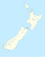
| Place: | Timaru , South Island , New Zealand | |
| Location: | Canterbury , New Zealand | |
| Geographical location: | 44 ° 26 '34.9 " S , 171 ° 15' 38.1" E | |
| Height of tower base: | 29 m | |
| Fire carrier height : | 9 m | |
|
|
||
| Identifier : | FL W 10s | |
| Scope knows: | 9 nm (16.7 km ) | |
| Operating mode: | electricity | |
| Function: | lighthouse | |
| Construction time: | 1866 | |
| Operating time: | since 1903 | |
The Tuhawaiki Point Lighthouse or Jack's Point Lighthouse is a still operating lighthouse located near Timaru on the east coast of the South Island of New Zealand .
geography
The lighthouse is located at Jack's Point 5 km south of Timaru . The South Island Main Trunk Railway passes the tower around 40 m inland . The lighthouse can be reached from New Zealand State Highway 1 via the small settlement of Scarborough .
Surname
The site is named after the Maori chief Hone (Jack) Tuhawaiki, who belonged to the Ngāi Tahu tribe.
history
The lighthouse was built in its current location in 1903 and was intended to replace the inadequate beacon in the port of Timaru . The cast-iron lighthouse was built in 1866 and initially served on Somes Island in Wellington Harbor until it was replaced by a new tower in 1900 and came to Timaru . Just one year after its construction south of Timaru , the beacon was automated and operated without personnel from 1930.

