Cuvier Island Lighthouse
| Cuvier Island Lighthouse | ||
|---|---|---|
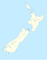
| Place: | Cuvier Island , Waikato , North Island , New Zealand | |
| Location: | Waikato , New Zealand | |
| Geographical location: | 36 ° 26 '23.5 " S , 175 ° 47' 9.7" O | |
| Height of tower base: | 119 m | |
| Fire carrier height : | 15 m | |
|
|
||
| Identifier : | FL W 15s | |
| Scope knows: | 19 nm (35.2 km ) | |
| Operating mode: | 1889 oil lamp 1939 electrification 1982 automated |
|
| Function: | lighthouse | |
| Construction time: | 1889 | |
| Operating time: | since 1889 | |
| International ordinal number: | K3886 | |
Cuvier Island Lighthouse is a lighthouse on Cuvier Island , a small island off the east coast of the Waikato region on the North Island of New Zealand . It is operated by Maritime New Zealand . It serves as a landmark on the approach to Waitemata Harbor and the Hauraki Gulf .
The tower was the first cast iron (instead of wood) lighthouse in New Zealand. It was put into operation on September 22nd, 1889 and initially illuminated by an oil lamp . In 1939 the tower was electrified and powered by a diesel generator.
The tower was automated in 1982 and, like all New Zealand lighthouses, has since been remotely controlled from a central control room at Maritime New Zealand's headquarters in Wellington . In 1996, due to the high costs of fuel supply, the power supply was switched to accumulators charged by solar cells.
Web links
- Cuvier Island (1889). New Zealand Lighthouses,accessed October 18, 2018.
Individual evidence
- ↑ a b c Cuvier Island . Maritime New Zealand , accessed October 18, 2018 .
