Baring Head Lighthouse
| Baring Head Lighthouse | ||
|---|---|---|
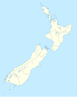
| Place: | Baring Head, North Island , New Zealand | |
| Location: | Wellington , New Zealand | |
| Geographical location: | 41 ° 24 '28.9 " S , 174 ° 52' 16.1" O | |
| Height of tower base: | 87 m | |
| Fire carrier height : | 12.2 m | |
|
|
||
| Identifier : | Oc. W 15s (9s on, 6s off) |
|
| Scope knows: | 10 nm (18.5 km ) | |
| Operating mode: | 1989 automated | |
| Function: | lighthouse | |
| Construction time: | 1935 | |
| Operating time: | since 1935 | |
Baring Head Lighthouse is a lighthouse on Baring Head in the Wellington region on the North Island of New Zealand . It is operated by Maritime New Zealand .
The tower is used for orientation on Cook Street and the entrance to Wellington Harbor . The octagonal concrete structure replaced a lighthouse on Pencarrow Head in 1935 . The beacon was initially supplied by a diesel generator, but was connected to the national power grid as early as 1950. In 1989 the lighthouse was automated and since then, like all lighthouses in New Zealand, it has been remotely controlled from a Maritime New Zealand control room in Wellington .
Individual evidence
- ↑ a b Baring Head . Maritime New Zealand , accessed October 18, 2018 .
