Katiki Point Lighthouse
| Katiki Point Lighthouse | ||
|---|---|---|
| Photo from 2007 | ||
| Place: | Moeraki , Otago , South Island , New Zealand | |
| Location: | Otago , New Zealand | |
| Geographical location: | 45 ° 23 '30.8 " S , 170 ° 51' 58.2" O | |
| Height of tower base: | 52 m | |
| Fire carrier height : | 8 m | |
|
|
||
| Identifier : | FL W 12s | |
| Scope knows: | 10 nm (18.5 km ) | |
| Operating mode: | electricity | |
| Function: | lighthouse | |
| Construction time: | 1876-1878 | |
| Operating time: | since 1878 | |
The Katiki Point Lighthouse is a lighthouse north of Dunedin on the east coast of the South Island of New Zealand .
geography
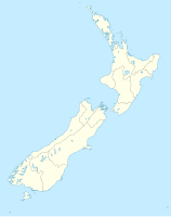
The lighthouse is located 80 km north of Dunedin and 4 km south of Moeraki at the northern end of Katiki Beach on a hill at Katiki Point , which protrudes into the Pacific Ocean here . The tower is accessible from Moeraki via Lighthouse Rd .
history
Since the port of Oamaru was developing alongside the port of Dunedin and shipping traffic off the coast between the two cities increased significantly, the Marine Department decided in 1876 to build a lighthouse halfway between the cities. Bad weather hindered the completion of the wooden tower and shortly before completion, a violent storm also destroyed the lamp glass of the beacon. Replaced by a better construction, the lighthouse went into operation in 1878. In 1975 the beacon was automated and replaced by LED lamps in December 2005.

