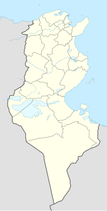
Dehiba (Tunisia)
Coordinates: 32 ° 1 ′ N , 10 ° 42 ′ E
Dehiba (also Dhiba , Arabic الذهيبة, DMG aḏ-Ḏahība ) is a Tunisian place on the border with Libya . It belongs to the Tataouine Governorate and has about 4000 inhabitants.
The Wazin border crossing to Libya is located near the village . In April 2011, thousands of people fled to Dehiba during the civil war in Libya . Fierce fighting broke out in the area on April 19, 2011 when rebels from the Libyan National Liberation Army captured the border crossing from the Libyan government forces . On April 28th there were again fierce skirmishes with several dead, with artillery pieces also being used. The Tunisian government protested because some of the fighting took place on Tunisian territory. The next day there was fighting between Libyan government troops and Tunisian units in the area.
Individual evidence
- ↑ a b Seven dead in NATO attacks on Tripoli. In: Neue Zürcher Zeitung . April 21, 2011, accessed April 21, 2011 .
- ↑ Institut National de la Statistique - Tunisie: Recensement de 2004 ( Memento of the original of September 24, 2015 in the Internet Archive ) Info: The archive link was inserted automatically and has not yet been checked. Please check the original and archive link according to the instructions and then remove this notice.
- ↑ Rice: "Reprehensible Deeds". In: ORF . April 29, 2011. Retrieved April 29, 2011 .
- ↑ Skirmishes with the Tunisian military. In: ORF. April 29, 2011. Retrieved April 29, 2011 .
