Deogyusan National Park
| Deogyusan National Park | ||
|---|---|---|
|
|
||
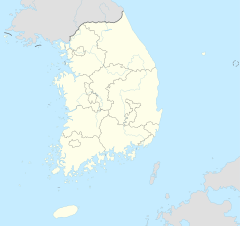
| Location: | Jeollabuk-do , South Korea | |
| Next city: | Muju | |
| Surface: | 231.65 km² | |
| Founding: | Feb. 1, 1968 | |
| Address: | Deogyusan National Park Office, Address: 7411-8, Samgong-ri, Seolcheon-myeon, Muju-gun, Jeollabuk-Do | |
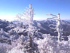
| Winter mood in the park | ||
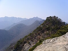
| The Gyeryong as seen from Jang-gun | ||
The Deogyusan National Park ( 덕유산 국립 공원 ) is the only national park in South Korea , a ski resort located on the territory. The next big city is Daegu , about 60 km to the east , from there the fastest way to get there is via expressways 12 and 35 .
Location and geography
The park is located in one of the foothills of the Baekdudaegan Mountains. It belongs to the catchment area of the Geumgang and the Nakdong . The highest point is the 1614-meter-high Hyangjeokbong peak. The park is also known for its waterfalls.
Flora and fauna
There are 1067 species of flora in the national park, such as the Korean fir . The animal species are divided into 32 mammals, 130 birds, 9 amphibians, 13 reptiles and 28 fish species as well as 1,337 types of insects.
Web links
Commons : National parks of South Korea - Collection of pictures, videos, and audio files
Individual evidence
- ↑ a b Gyeryongsan National Park . Korea National Park Service.
- ↑ http://german.visitkorea.or.kr/ger/SI/SI_GE_3_1_1_2.jsp?cid=335411


