Douglas Strait
| Douglas Strait | ||
|---|---|---|
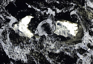
| Satellite image of Douglas Strait between Morrell Island (left) and Cook Island (right) | ||
| Connects waters | South Atlantic | |
| with water | South Atlantic | |
| Separates land mass | Thule Island | |
| of land mass | Cook Island | |
| Data | ||
| Geographical location | 59 ° 25 ′ 58 ″ S , 27 ° 17 ′ 6 ″ W | |
|
|
||
| Smallest width | 3 km | |
| Islands | Twitcher skirt | |
The Douglas Strait , is a 3 km wide strait in the archipelago of the South Sandwich Islands . In the group of the South Thul Islands , it separates the Morrell Island from Cook Island . The cliff rock Twitcher Rock is located in the strait 1.1 km southeast of Morrell Island.
Participants in the first Russian Antarctic expedition (1819–1821) under the direction of the German-Baltic seafarer Fabian Gottlieb von Bellingshausen are considered to have discovered this sea route in 1820 . Scientists from the British Discovery Investigations mapped it in 1930 and named it after Percy Douglas (1876-1939), a member of the committee of this research series.
Web links
- Douglas Strait in the Geographic Names Information System of the United States Geological Survey (English)
- Douglas Strait on geographic.org (English)

