
Morrell Island
| Morrell Island (Thule) | ||
|---|---|---|
 |
||
| Waters | South Atlantic | |
| Archipelago | Southern Thule Islands | |
| Geographical location | 59 ° 26 '24 " S , 27 ° 22' 18" W | |
|
||
| length | 7 km | |
| width | 5 km | |
| surface | 14 km² | |
| Highest elevation |
Mount Larsen 710 m |
|
| Residents | uninhabited | |
| main place |
Corbeta Uruguay (former station) |
|
 |
||

The island of Morrell Island ( English Morrell Island ) is the second largest of the three islands in the South Atlantic , located in the sub-Antarctic archipelago of the South Sandwich Islands , which form the group of the South Thul Islands . It is named after Benjamin Morrell . Name variants are Süd-Thule , English Thule Island and Spanish Tule del Sur .
Morrell is separated from the nearest, east neighboring Cook Island by the Douglas Strait , which is about four kilometers wide . The island is dominated by the caldera of the Mount Larsen volcano , which measures 1.5 by 2 kilometers. The terrain rises steeply to the caldera.
1300 meters east of Hewison Point, the southeastern end of the island, is the small and steep rock Twitcher Rock , with a diameter of 140 to 150 meters and a height of 55 meters.
The island with an area of around 14 km² is uninhabited, but offers an important nesting area for numerous sea birds .
In 1775 the island was discovered by the British navigator James Cook .
From 1976 to 1982, the permanently manned Argentine research station Corbeta Uruguay was located at Ferguson Bay on the flat peninsula in the southeast of Morrell Island . Argentina also uses this name for the peninsula, Península Corbeta Uruguay . A few hundred meters west of it, Argentina built the Refugio Teniente Esquivel summer station in January 1955 , but had to be abandoned a year later due to a volcanic eruption of Mount Harmer on the neighboring Cook Island.

Refugio Teniente Esquivel (1955–56)

See also
Individual evidence
- ↑ http://www.histarmar.com.ar/Antartida/RefugioThule2-ElYeti.htm
- ↑ http://www.histarmar.com.ar/Antartida/RefugioThule1-.htm
Web links
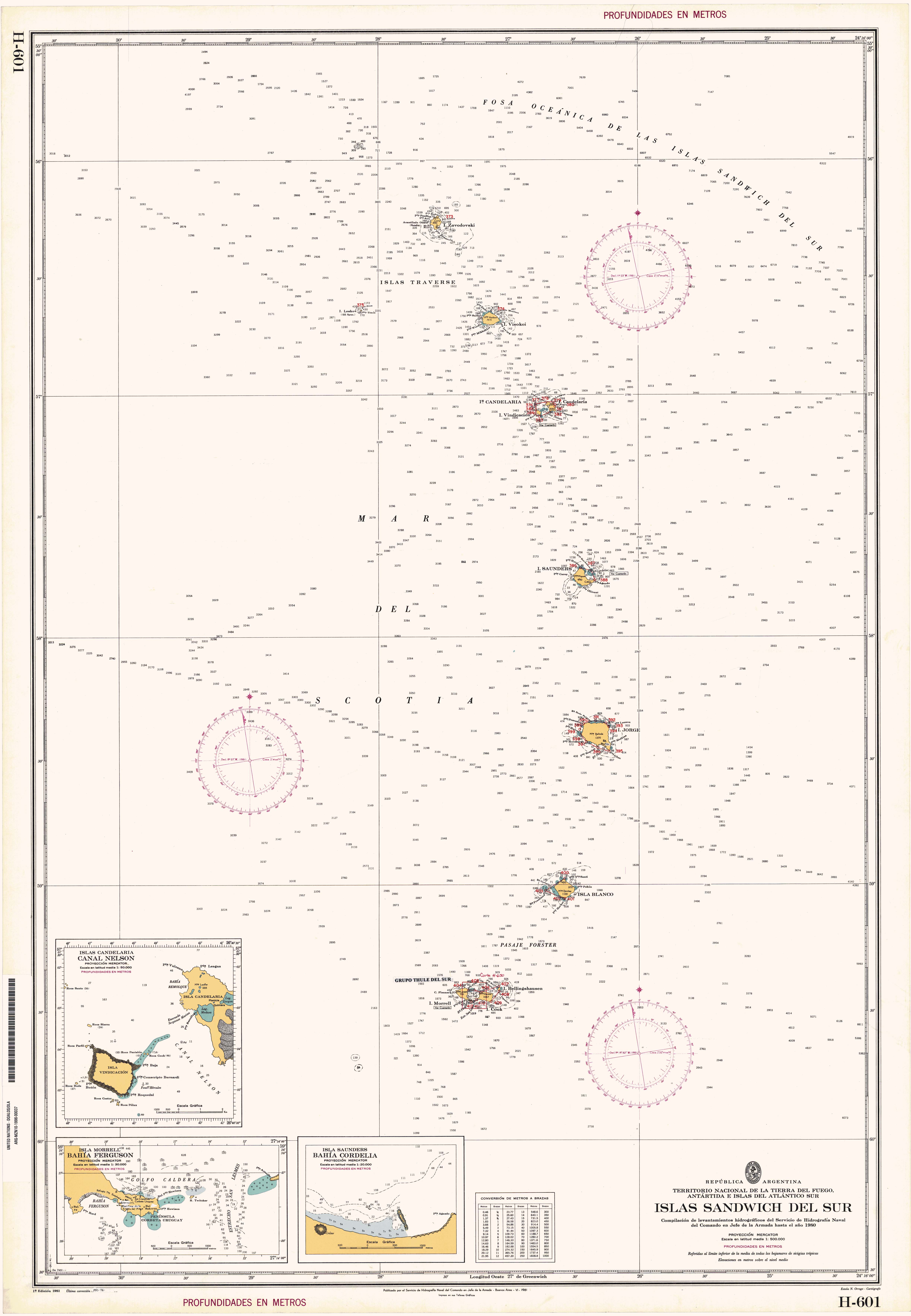
- Argentine sea map of the South Sandwich Islands with inset 1: 30,000 Isla Morrell / Bahía Ferguson
South Georgia : Annenkov | Bird | Clerke Rocks | Cooper | Grass | Kupriyanov | Pickersgill | Shag Rocks | South Georgia | Willis | Welcome
South Sandwich Islands : Bellingshausen | Bristol | Candlemas | Cook | Leskov | Montagu | Morrell (Thule) | Saunders | Vindication | Visokoi | Zavodovski