Drummond Island
| Drummond Island | ||
|---|---|---|
| Waters | Lake Huron | |
| Archipelago | Manitoulin island chain | |
| Geographical location | 46 ° 0 ′ N , 83 ° 40 ′ W | |
|
|
||
| surface | 334.3 km² | |
| Residents | 992 (2000) 3 inhabitants / km² |
|
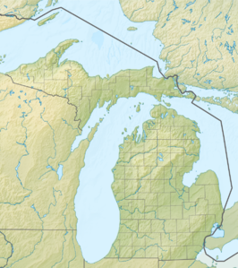
Drummond Island is an island in the Huron Sea . It belongs to Chippewa County in the US state of Michigan . It is the only island in the Manitoulin island chain that belongs to the USA.
The island is separated in the east by the False Detour Channel from the neighboring island of Ontario, Cockburn Island . To the west it is separated from the tip of the Upper Peninsula by a narrow channel . There is a ferry connection to De Tour Village . To the northwest is Potagannissing Bay and to the north is the North Channel .
After the British-American War in 1812, the island was occupied by the British. It was the last British outpost on American soil according to the Peace of Ghent . In 1828 the island passed to the American government.
Web links
- Drummond Island Tourism Association (English)
