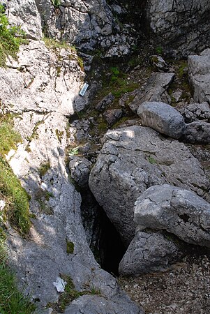
Elm cave system
| Elm cave system
|
||
|---|---|---|
|
Small wind hole |
||
| Location: | Styria , Austria | |
| Height : | 1653 m above sea level A. | |
|
Geographic location: |
47 ° 40 ′ 59 " N , 13 ° 57 ′ 20" E | |
|
|
||
| Cadastral number: | 1624/38 | |
| Geology: | Dachstein Limestone | |
| Type: | Rift cave | |
| Discovery: | Research began in 1908 | |
| Overall length: | 5,472 m (as of March 2014) | |
| Level difference: | 354 m (as of January 2014) | |
The Elm cave system is located in the Styrian part of the Dead Mountains near the Elmsee in the Grundlsee municipality . The small wind hole and the large wind hole form the entrances to the cave system, which essentially consists of three main parts: the east corridor (large wind hole), west corridor (large wind hole) and Salzburg corridor (small wind hole).
Individual evidence
- ↑ a b The longest and deepest caves of the Dead Mountains and the Dachstein (Styrian part). Association for Speleology in Upper Styria (VHO), accessed on November 26, 2018 .
- ↑ Willi Repis: Die Höhle, magazine for Karst and Höhlenkunde, Issue 3, 14th year, September 1963. The Elm cave system in the Dead Mountains. Association of Austrian Speleologists, accessed on November 26, 2018 .

