Borowa (Smijiw)
| Borowa | ||
| Борова | ||

|
|
|
| Basic data | ||
|---|---|---|
| Oblast : | Kharkiv Oblast | |
| Rajon : | Smiyiv Raion | |
| Height : | 132 m | |
| Area : | 3,656 km² | |
| Residents : | 2,419 (2001) | |
| Population density : | 662 inhabitants per km² | |
| Postcodes : | 63410 | |
| Area code : | +380 5747 | |
| Geographic location : | 49 ° 48 ' N , 36 ° 19' E | |
| KOATUU : | 6321781001 | |
| Administrative structure : | 8 villages | |
| Address: | вул. Центральна буд. 124 63 410 с. Борова |
|
| Website : | City council website | |
| Statistical information | ||
|
|
||
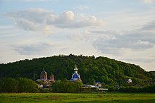
Borowa ( Ukrainian Борова ; Russian Боровая Borowaja ) is a village in the Ukrainian Oblast Kharkiv with about 2,400 inhabitants (2001).
The village, founded in 1660, is the administrative center of the district council of the same name, 91.104 km² in the north of Smijiw Rajon , to which the villages Vodjane ( Водяне , ⊙ ) with about 300 inhabitants, Hussyna Polyana ( Гусина Поляна , ⊙ ) with about 600 inhabitants, Swidky ( Звідки , ⊙ ) with about 200 inhabitants Kostjantiwka ( Костянтівка , ⊙ ) with about 400 inhabitants, Krasna Poljana ( Красна Поляна , ⊙ ) with about 400 inhabitants Petryschtschewe ( Петрищеве , ⊙ ) with about 30 inhabitants and Repjachiwka ( Реп ' яхівка , ⊙ ) with about 5 inhabitants.

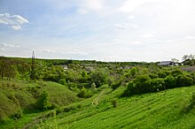
The village is located on the right bank of the Udy , a 164 km long tributary of the Siverskyi Donets , about 14 km north of the Smiyiv district center and 27 km south of the Kharkiv oblast center . The Kharkiv – Horlivka railway and the P – 78 regional road run through the municipality .
Web links
Individual evidence
- ↑ Local website on the official website of the Verkhovna Rada ; accessed on November 26, 2018 (Ukrainian)
- ^ Local history Borowa in the history of the cities and villages of the Ukrainian SSR ; accessed on November 26, 2018 (Ukrainian)
- ^ Website of the district council on the official website of the Verkhovna Rada; accessed on November 26, 2018 (Ukrainian)


