Ernir (Skutulsfjörður)
| Ernir | ||
|---|---|---|
|
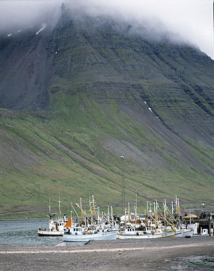
The steep slopes of Ernir behind the port of Ísafjörður |
||
| height | 628 m | |
| location | Iceland | |
| Coordinates | 66 ° 3 '59 " N , 23 ° 4' 18" W | |
|
|
||
|
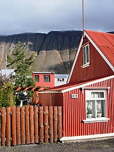
Ernir behind houses in Ísafjörður |
||
Ernir is a mountain in northwest Iceland in Vestfirðir and is 628 m high.
location
It towers across from the town of Ísafjörður on the east side of the Skutulsfjörður fjord .
Surname
The name of the mountain means Adlerberg (actually German the eagle , ernir is the plural of isl. Örn ).
description
A hanging valley called Naustahvílft cuts into it . This was created by an ice age glacier that was there for a long time after the glaciers that were resting on the plateaus disappeared.
As in many mountains in the Westfjords, its slopes are very steep. The glaciers of the Ice Age worked here during the cold periods of an Ice Age that lasted 3 million years, lava layers that are in turn 13-14 million old. The oldest rock in Iceland is in the Westfjords. This can be explained by the fact that at the time, ie over 13 million years ago, they were above the hot spot and the plate boundary ran over them. It pushed the descending material ( magma ) from the earth's interior further and further away from the active volcanic zone, which was shifting to the east.
Traffic obstruction
In snowy winters, there is a risk of avalanches below the mountain on the connecting road that leads to Súðavík and on to Reykjavík . Therefore, as in some places in Iceland, the construction of a tunnel is being considered.
Hiking on the mountain
You can hike up the mountain through the Naustahvílft hanging valley.
See also
Individual evidence
- ^ Ari Trausti Guðmundsson, Pétur Þorleifsson: Íslensk fjöll. Gönguleiðir á 101 tind. Reykjavík 2004, p. 56f.


