Skutulsfjörður
| Skutulsfjörður | ||
|---|---|---|
|
The place Ísafjörður in Skutulsfjörður |
||
| Waters | Ísafjarðardjúp | |
| Land mass | Iceland | |
| Geographical location | 66 ° 5 ′ 0 ″ N , 23 ° 6 ′ 12 ″ W | |
|
|
||
| width | 3 km | |
| depth | 7 km | |
| Tributaries | Tunguá, Langá | |
|
Skutulsfjörður in 1925 |
||
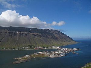
The Skutulsfjörður is a fjord in the West Fjords of Iceland .
The town of Ísafjörður is located on the Eyri peninsula in Skutulsfjörður . The fjord is the westernmost in Ísafjarðardjúp . It is around 3 km wide and extends over 7 km into the land that divides into the Engidalur and Tungudalur valleys on Mount Kubbi. Vestfjarðavegur ran through the last one, the northern one, ![]() before Vestfjarðagöng was opened in 1996 . Since then this road has taken a different route and connects the city with the ring road
before Vestfjarðagöng was opened in 1996 . Since then this road has taken a different route and connects the city with the ring road ![]() . The Djúpvegur
. The Djúpvegur ![]() circles the fjord and leads through other fjords in Ísafjarðardjúp. Ísafjörður Airport is located on the Skipeyri headland in the southwest of the fjord and is difficult to fly to because of the surrounding mountains.
circles the fjord and leads through other fjords in Ísafjarðardjúp. Ísafjörður Airport is located on the Skipeyri headland in the southwest of the fjord and is difficult to fly to because of the surrounding mountains.


