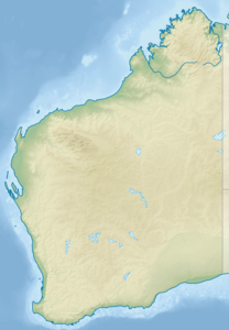
Fish Hook Bay
| Fish Hook Bay | ||
|---|---|---|
| Waters | Indian Ocean | |
| Land mass | Rottnest Island | |
| Geographical location | 32 ° 1 '26.1 " S , 115 ° 27' 5.2" E | |
|
|
||
| width | 130 m | |
| depth | 170 m | |
| Coastline | 430 m | |
Fish Hook Bay is a bay on Rottnest Island in the Australian state of Western Australia . The bay is the westernmost bay on the island.
The name of the bay comes from its shape, which resembles a fish hook.
geography
Fish Hook Bay is 120 feet wide and 170 feet deep. It opens to the north. To the east of the bay is Wilson Bay and to the north is the small Eagle Bay , which is separated from Cape Vlaming by Fish Hook Bay .
The bay's 430 meter long coastline has no beach.
Individual evidence
- ↑ Fish Hook Bay About-Australia.com (English). Last accessed June 7, 2017
