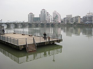
Futun Xi
| Futun Xi | ||
|
Futun Xi at Laizhou |
||
| Data | ||
| location | prefecture-level city of Nanping , Fujian , China | |
| River system | Min Jiang (Fujian) | |
| Drain over | Min Jiang → East China Sea | |
| origin | At the confluence of Xi and Xi Xi at Guangze 27 ° 32 '33 " N , 117 ° 21' 2" O |
|
| confluence | west of the urban area of Nanping with the Sha Xi to Min Jiang Coordinates: 26 ° 34 ′ 29 ″ N , 118 ° 2 ′ 13 ″ E, 26 ° 34 ′ 29 ″ N , 118 ° 2 ′ 13 ″ E
|
|
| length | 285 km | |
| Catchment area | 13,733 km² | |
| Runoff at Yangkou gauge |
NNQ MQ HHQ (1954) |
224 m³ / s 444 m³ / s 698 m³ / s |
|
Bayi Bridge over the Futun Xi in Shaowu |
||
The Futun Xi ( Chinese 富屯溪 , Pinyin Fùtún xī ) is a river in the southeast Chinese province of Fujian . It rises in the Wuyi Mountains in the northwest of the province and then flows through the towns of Guangze , Shaowu and Shunchang . A few kilometers above Nanping it flows together with the Sha Xi and forms the Min Jiang . It is one of the three major tributaries of the Min Jiang on its upper reaches.
The Futun Xi has a length of 285 kilometers and an area of influence of 13,733 square kilometers. Its gradient is 1.2 per thousand. It has two tributaries, the Jin Xi and the Little Futun Xi.
At the measuring point near Yangkou , an annual average of 444 cubic meters of water per second flowed off. The highest value so far was determined in 1954 with 698 cubic meters per second, the lowest value with 224 cubic meters per second. Three quarters of the water flows away in the spring and summer months. In June, 22.1% of the total annual volume flows through the measuring point, compared to 2.8% in January.
Individual evidence
- ↑ a b c 南平 市 人民政府 办公室 关于 印发 富屯溪 、 建 溪 流域 500 平方公里 以下 河流 流域 综合 规划 的 通知.南平 市 人民政府 办公室, September 1, 2017, accessed on July 16, 2018 (Chinese).
- ↑ a b 刘学沛: 福建省 志 地理 志 . 1st edition. 方志 出版社, 北京 2001, ISBN 7-80122-612-7 , pp. 97 (Chinese).

