Glacier Col
| Glacier Col | |||
|---|---|---|---|
| Compass direction | West ( Lyell Lake ) |
East ( Middle Hamberg Lake ) |
|
| location | South Georgia , South Atlantic | ||
| map | |||
|
|
|||
| Coordinates | 54 ° 19 ′ 4 ″ S , 36 ° 33 ′ 40 ″ W | ||
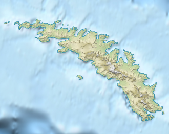
The Glacier Col (English for glacier saddle ) is a previously glaciated mountain pass on South Georgia in the South Atlantic . It lies between the northern end of Lyell Lake and Middle Hamberg Lake .
For the scientists stationed at King Edward Point , the saddle was a preferred ski area and the name had long been established. Despite the almost complete disappearance of the glacier ice by 2006, the UK Antarctic Place-Names Committee recognized this designation in 2007.
Web links
- Glacier Col . Entry in the database of the UK Antarctic Place-Names Committee for South Georgia and the South Sandwich Islands (English)
