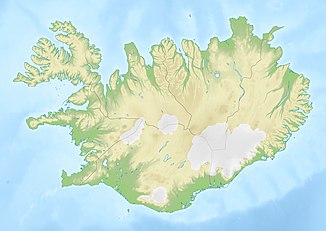
Gljúfursárfoss
| Gljúfursárfoss | ||
|---|---|---|
|
The Gljúfursárfoss |
||
| Coordinates | 65 ° 44 '52.1 " N , 14 ° 40' 36.1" W | |
|
|
||
| place | Vopnafjörður , Iceland | |
| height | 45 m | |
| flow | Gljúfursá | |
The Gljúfursárfoss is a waterfall on the coast in the east of Iceland in the town of Vopnafjörður .
The waterfall is located north of Hlíðarvegur (road 917), which is the shortest connection to Egilsstaðir , but is not always easy to drive. The Gljúfursá River used to be dangerous to cross on foot or on horseback . Above the current bridge (1997) there is the former road bridge and ruins of the first bridge there, which was built around 1900.
The Gljúfursá or more precisely the Gljúfursá í Vopnafirði plunges about 45 m down here and flows only about 150 m further into the bay Árvík east of the Drangsnes headland.
See also
Individual evidence
- ↑ Gljúfursárfoss - Drangsnes. Retrieved March 29, 2019 (Icelandic).
- ↑ Brúaskrá og stærstu bryr. Retrieved March 29, 2019 (Icelandic).
- ↑ Gljúfursárfoss. Accessed March 29, 2019 .

