Gohar Tepe
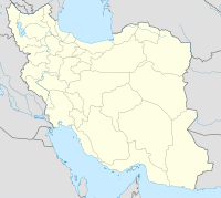
Coordinates: 36 ° 40 ′ 43 " N , 53 ° 24 ′ 1" E
Gohar Tepe ( Persian گوهر تپه Jewel Hill ) is an archaeological site in the Iranian province of Mazandaran .
geography
The place is about 33 kilometers east of the provincial capital Sari on the southern edge of the coastal plain on the Caspian Sea. The Alborz Mountains begin just a few hundred meters south, while the coast of the sea is less than ten kilometers away to the north.
Research history
Archaeological investigations by the Cultural Heritage Organization of Mazandaran have been taking place in Gohar Tepe since 2003 and have been carried out as a joint project with the Ludwig Maximilians University of Munich since spring 2009 . With a total area of approximately 50 hectares, Gohar Tepe is the largest archaeological site in all of Mazandaran.
Previous research results
Gohar Tepe was settled from the late Chalcolithic (middle of the 4th millennium BC) to the middle Iron Age (middle of the 1st millennium BC). In the late 4th and early 3rd millennium BC A large, city-like settlement emerged here, which must certainly have been one of the most important places in northeastern Iran. When the settlement started in the middle of the 3rd millennium BC. In BC, large areas of the hill were used as burial grounds. The Iranian and German archaeologists have so far been able to excavate a large number of graves from the Middle and Late Bronze Ages as well as the Early Iron Age.

