Gulf of Tolo
| Gulf of Tolo | ||
|---|---|---|
| Waters | Banda Lake | |
| Land mass | Sulawesi | |
| Geographical location | 2 ° 6 ′ S , 122 ° 20 ′ E | |
|
|
||
| width | approx. 200 km | |
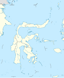
The Gulf of Tolo ( Indonesian Teluk Tolo ) is a wide, triangular bay of the Banda Sea in the east of the Indonesian island of Sulawesi (formerly Celebes ), which separates the eastern (Semenanjung Timur) and southeastern peninsula (Semenanjung Tenggara) from each other. The western tip of the triangle is formed by the narrow Gulf of Towori (Teluk Towori) ( 1 ° 59 ′ S , 121 ° 31 ′ E ), and in the northeast, the Banggai Islands separate the bay from the Moluccan Sea . The entire coastline belongs to the Sulawesi Tengah province .
