Pit crack
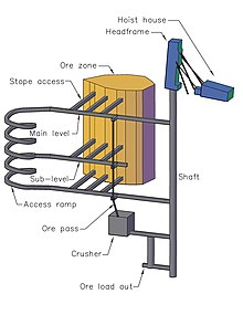
A pit plan is in the surveying of mining ( Markscheidewesen ) a topographical drawing on which the plans for a pit , are inclusive of the rocks and of the results of surveying work, is shown.
The surveying work can be carried out underground and / or above ground. In particular, shafts, tunnels, routes and mining areas are measured underground, and ground plans, for example of buildings, roads and properties, are created above ground. Older pit cracks often include detail in elevation sketches, especially of buildings.
The oldest pit cracks date from the 16th century. Their number increased in the 17th and 18th centuries.
Pit cracks also allow the identification of pit names for heaps and other mining remains in the area.
See also
Web links
Commons : Mine Schemes and Diagrams - Collection of Images

