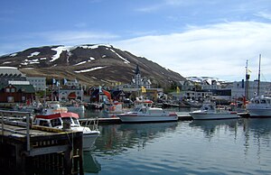
Húsavíkurfjall
| Húsavíkurfjall | ||
|---|---|---|
|
Húsavík and Húsavíkurfjall |
||
| height | 417 m | |
| location | Northeast of Iceland | |
| Coordinates | 66 ° 3 ′ 0 ″ N , 17 ° 18 ′ 0 ″ W | |
|
|
||
| Type | Volcano (extinct) | |
|
Húsavík with its local mountain |
||
The Húsavíkurfjall is a volcanic mountain in northeast Iceland above the small town of Húsavík .
location
The mountain is located in the east of Húsavík, about 2 km east of the Skjálfandi bay .
geology
At the foot of the Húsavíkurfjall lies a large fault with a NW-SE direction. This fault, which is part of the geologically active Tjörnes Fracture Zone , has been active for 9 million years.
Hiking on the mountain
You can also follow a jeep track on the mountain that leads out to the east in the direction of Reykjaheiði from Húsavík. But it is more attractive to go up the mountain from the north or northwest.
A walk at the foot of the mountain leads to Lake Botnsvatn with its nature reserve.
See also
Web links
Individual evidence
- ↑ Íslandshandbókin. Náttúra, saga og sérkenni. 1. bindi. Edited by T. Einarsson, H. Magnússon. Reykjavík (Örn og Örlygur) 1989, p. 480
- ↑ Thor Thordarson, Armann Hoskuldsson: Iceland. Classic Geology in Europe 3. Harpenden (Terra) 2002, p. 144
- ^ Ari Trausti Guðmundsson, Pétur Þorleifsson: Íslensk fjöll. Gönguleiðir á 151 tind. Reykjavík (Mál og Menning) 2004, p.


