Hadersleben dam
|
Hadersleben Dam Haderslev Dam |
||
|---|---|---|

|
||
| Geographical location | Haderslev , Denmark | |
| Drain | Mühlenstrom → Hadersleben Fjord | |
| Data | ||
| Coordinates | 55 ° 14 ′ 18 ″ N , 9 ° 27 ′ 6 ″ E | |
|
|
||
| length | 6 km | |
| width | 1 km | |
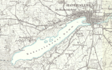
The Haderslebener Damm ( Danish Haderslev Dam ) is a lake immediately west of the old town of Haderslev (dt. Hadersleben ) in Denmark . In its current extent, it was created in the Middle Ages by damming the water mill to the south of the city. The lake is connected to the Hadersleben Fjord by the Mühlenstrom . The name Damm comes from the Danish word for an artificial pond ( dam ).
location and size
The lake, which is six kilometers long and up to one kilometer wide, is now divided into three parts, because both the western end (Hindemai / Hindemade) and the section close to the city (Innerdamm) are separated by dams from the approximately 260 hectare main body of water. The inner dam was separated in the 1950s, when the former A 10 trunk road, the most important north-south connection between Germany and Denmark until today's E 45 motorway was built , was relocated west of Hadersleben's old town. The dam stretches through the Hadersleben glacial valley, which also includes the narrow fjord.
description
While the western part of the lake with its partly wooded and partly swampy surroundings is partly under nature protection, the eastern part close to the city is integrated into a park, in which numerous events take place, especially in summer. There are several playgrounds, a herb garden and a network of walking paths. The former village of Erleff, located on the south bank not far from the old town, has grown considerably in recent years, mainly due to the development of single-family houses. On the north bank lies Alt-Hadersleben, originally a village with suburban character that existed next to the town of the same name and was only fully incorporated in 1910, through which the main road to Ribe ( German: Ripen ) runs. Immediately to the east of the bypass is the Romanesque Alt-Hadersleben St. Severinskirche, which with its high tower dominates the north bank of the Innerdamm. At the northwest end of the lake is Damende , a well known restaurant.
Special
Haderslebener Damm is a popular area for rowers and canoeists.
Dammende used to be the starting and ending point for excursion traffic with small ships, which was discontinued many years ago. The ship disaster on Haderslebener Damm , which killed 57 people on July 8, 1959, gained notoriety . A memorial stone was unveiled near the site of the accident on the 50th anniversary.
literature
- Sønderjyllands nye søer i editorial by Jesper Tofft
- Hans Ole Matthiensen: Sønderjylland naturguide
- Haderslev i 700 år ; udgivet i notification of byens købstadsjubilæum
- Wilhelm Lorenzen Fabricius: Haderslev Tunneldal
- Skov and naturstyrelsen: Pamhule and Haderslev Sønderskov
- Skov- og naturstyrelsen: Pamhule og Hindemade
- Miljøministeriet : Pamhule og Hindemade
- Miljøministeriet / Skov- og Naturstyrelsen / Haderslev Statsskovdistrikt: Hindemade
- Skov- og Naturstyrelsen / Haderslev Statsskovdistrikt: Dyrehaven ved Haderslev
- Sønderjyllands Amt / Teknisk forvaltning: Tunneldalstierne
- TO Achelis: Haderslev i Gamle Dage
- HP Jensen: Art i Haderslev
Individual evidence
- ↑ Topographic map "Preussiske kort 1880"
- ↑ restaurant Damende. Retrieved February 29, 2016 (Danish).


