
Limassol Harbor
| Limassol Harbor | |||
|---|---|---|---|
| Data | |||
| UN / LOCODE | CY LMS | ||
| operator | Cyprus Ports Authority et al | ||
| Port type | Protective and commercial port | ||
| Total area of the port | 2.3 million m² | ||
| Passengers | 300,000 | ||
| Throughput | 10 million t (2014) | ||
| Container (TEU) | 308,000 TEU | ||
| website | www.CPA.GOV.CY | ||
| Geographic information | |||
| place | Limassol | ||
| republic | Republic of Cyprus | ||
| Country | Republic of Cyprus | ||
 |
|||
| Coordinates | 34 ° 38 '44 " N , 33 ° 0' 31" E | ||
|
|||

The port of Limassol ( Greek Λιμάνι Λεμεσού , Limani tis Lemesos ) is the most important port in Cyprus .
geography
The port facilities of Limassol , the second largest city on the island, are located southwest of the historic city center in Limassol Bay , a bay northeast of the Akrotiri peninsula on the Mediterranean . The Garyllis river , which rises in the Troodos Mountains north of Limassol, flows into the sea in the port . ⊙ The port facilities include around 130 hectares of landing facilities and 100 hectares of lake area.
They are divided into several parts of the port specially adapted for the respective purposes: Map with all coordinates: OSM | WikiMap![]()
| Port part | Port type | location | Quay length | depth | use | |
|---|---|---|---|---|---|---|
| new port, south pier | Harbor basin | ⊙ | 300 m, quay wall | 16 m | Police, work boats, 50 m ro-ro ramp | |
| new port, west pier | Harbor basin | ⊙ | 450 + 320 m, quay wall | 11-16 m | Reefer, container terminal, 50 m RoRo ramp | |
| new port, north pier | Harbor basin | ⊙ | 430 m, quay wall | 11 m | Passenger ships, tugs | |
| new port, east pier | Harbor basin | ⊙ | 480 m, quay wall | 11 m | UN ships | |
| Marina | Marina | ⊙ | Quays and jetties | 4-9 m | 640 berths for recreational boating | |
| Old Port | Harbor basin | ⊙ | 450 m, quay walls | 2.5-4.5 m | Sightseeing tours, police, pleasure boating | |
| Fishing terminals | Piers | ⊙ | Sponged 3 × 10 m | 3 covered piers for fishing boats | ||
| Passenger terminal | Pier | ⊙ | 17 m, (115 m offshore) | open pier for passenger shipping | ||
| Sailing center | Marina | ⊙ | Quays and jetties | 4 m | 230 berths for recreational boating |
The western port areas are reserved for large commercial shipping. There is a two-kilometer long breakwater in front of the port facilities , so that normally only one meter of waves and tidal range have to be expected in the port basin .
To the east of the port basin of the new port are the marina and the old port, which are also protected by breakwaters in three sections with a total length of over one kilometer. Gastronomy and leisure facilities dominate there.
Additional port facilities are located along the Limassol Molos Promenade . These are almost unprotected on the open sea and are used for both fishing and passenger shipping.
Clearly separated, ten kilometers further east, is Limassol's sailing center, the St. Raphael Marina with its own adapted infrastructure. This serves exclusively for recreational shipping and tourist purposes. This is completely irrelevant for commercial large-scale shipping. There are two breakwaters there with a total length of 600 m.
gallery
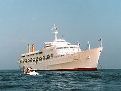
SS Canberra (1984)

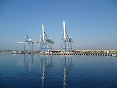
Container Terminal (2006)
New port, view from the southeast (2011)

The old harbor, view from the south pier (2012)

left: jetty passenger shipping, right the fishing terminals (2014)
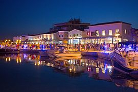
Marina Limassol (2014)

Sailing Center from the West (2014)

UN Security Service (2016)


.jpg)