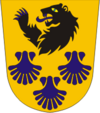
Halinga
| Halinga | |||
|
|||
| State : |
|
||
| Circle : |
|
||
| Coordinates : | 58 ° 37 ′ N , 24 ° 30 ′ E | ||
| Area : | 365 km² | ||
| Residents : | 3,239 (01.2010) | ||
| Population density : | 9 inhabitants per km² | ||
| Time zone : | EET (UTC + 2) | ||
| Community type: | former rural community | ||
| Postal address : | Uus 53 87201 Pärnu-Jaagupi |
||

|
|||
Halinga (until 1939 Hallinga , German: Hallik or Hallick ) is a former rural community in the north of the Estonian district of Pärnu . In 2017 Halinga was incorporated into the rural municipality of Põhja-Pärnumaa .
3239 inhabitants lived in an area of 365 km² (as of January 1, 2010). The center of the rural community was Pärnu-Jaagupi . 43 other villages belonged to it: Aasa, Altküla, Anelema, Arase, Eametsa, Eense, Eerma, Enge, Ertsma, Halinga, Helenurme, Kablima, Kaelase, Kangru, Kodesmaa, Kuninga, Langerma, Lehtmetsa, Lehu, Libatse, Loomse, Maima , Mõisaküla, Mäeküla, Naartse, Oese, Pallika, Pereküla, Pitsalu, Pööravere, Roodi, Rukkiküla, Salu, Sepaküla, Soosalu, Sõõrike, Tarva, Tõrdu, Tühjasma, Vahenurme, Vakalepa, Valistre.
The St. Jakobi Church in Pärnu-Jaagupi, built in 1534, is one of the last Catholic sacred buildings in Estonia. The baroque pulpit from around 1660 was made by the well-known Danish woodcarver Elert Thiele , the altar from 1794.

