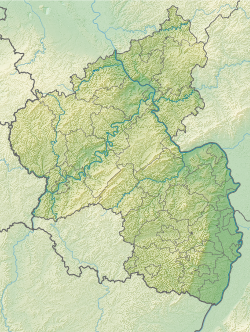
Hinkelstein (Dautenheim)
| Hinkelstein (Dautenheim) | ||
|---|---|---|
|
|
||
| Coordinates | 49 ° 43 '53 " N , 8 ° 9' 13.9" E | |
| place | Dautenheim , Alzey-Worms district , Rhineland-Palatinate , Germany | |
The menhir is a menhir at Dautenheim , a district of Alzey in Alzey-Worms in Rhineland-Palatinate .
Location and description
The Hinkelstein is about 1 km southeast of Dautenheim on the Kloppberg just below the highest point. It originally marked the border between Dautenheim and the Huckenhof. Late Bronze Age finds were recovered 250 m to the north-west , which could point to destroyed burial mounds, a settlement or a sacrificial site.
The menhir consists of limestone , the place of origin of which the nearby valley slope could be identified. It has a heavily weathered, holey surface. It has a height of 100 cm, a width of 80 cm and a depth of 70 cm. It is irregularly shaped and has strongly rounded edges.
literature
- Georg Durst: The monoliths of the province of Rheinhessen. In: Mainz magazine. Volume 33, 1928, pp. 14-15.
- Otto Gödel: Menhirs, witnesses of cult, border and legal customs in the Palatinate, Rheinhessen and the Saar area. Speyer 1987, p. 61ff.
- Johannes Groht: Menhirs in Germany. State Office for Monument Preservation and Archeology Saxony-Anhalt, Halle (Saale) 2013, ISBN 978-3-943904-18-5 , pp. 297, 327–328.
- Horst Kirchner: The menhirs in Central Europe and the menhir thought. Academy of Sciences and Literature, Treatises of the Humanities and Social Sciences Class, Born 1955, No. 9, Wiesbaden 1955, p. 159.
- Detert Zylmann: The riddle of the menhirs. Probst, Mainz-Kostheim 2003, ISBN 978-3-936326-07-9 , p. 103.
- Monument topography Federal Republic of Germany : Cultural monuments in Rhineland-Palatinate Volume 20.2: District of Alzey-Worms . City of Alzey . Published on behalf of the Ministry of Education, Science, Further Education and Culture by the General Directorate for Cultural Heritage Rhineland-Palatinate Directorate State Monument Preservation. Edited by Michael Huyer and Dieter Krienke. Wernersche Verlagsgesellschaft : Worms 2014. ISBN 978-3-88462-326-8 ; Pp. 182-183
Web links
Individual evidence
- ^ Johannes Groht: Menhirs in Germany. P. 327.
