Ilhéu Chão
| Ilhéu Chão | ||
|---|---|---|
| North coast of the Ilhéu Chão with the Prego do mar | ||
| Waters | North Atlantic | |
| Geographical location | 32 ° 35 ′ N , 16 ° 33 ′ W | |
|
|
||
| length | 1600 m | |
| width | 500 m | |
| surface | 1 km² | |
| Highest elevation | La Testa 98 m |
|
| Residents | uninhabited | |
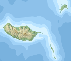
Ilhéu Chão is the smallest island of the Portuguese Ilhas Desertas in the North Atlantic . To the south lies the neighboring island of Deserta Grande . To the north there is a rock needle in the sea, the Prego do mar ( German sea nail , also Farilhão ).
The Ilhéu Chão has an area of 1 km², with a length in north-south direction of 1600 m and a width of about 500 m. The island appears as a rock plateau with a relatively constant height of 80 m . At its highest point it reaches 98 m . There has been a 14 m high lighthouse there since 1959 .
Individual evidence
- ↑ Map of the Madeira Islands
- ↑ aróis de Portugal
- ↑ Reserva Natural das Ilhas Desertas: Desertas - área protegida reconhecida pelo conselho da Europa , accessed on July 29, 2014.

