Prego do mar
| Prego do mar (Farilhao) |
||
|---|---|---|
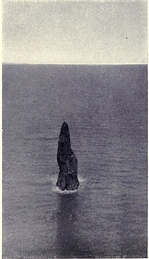
| The Prego do mar (photo from 1909) | ||
| Waters | North Atlantic | |
| Archipelago | Ilhas Desertas | |
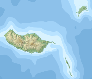
| Geographical location | 32 ° 35 '31.54 " N , 16 ° 32' 43.15" W | |
|
|
||
| length | 23 m | |
| width | 16 m | |
| surface | 0.03 ha | |
| Highest elevation | 49 m | |
| Residents | uninhabited | |
| The steep cliff of Ilhéu Chão with the Prego do mar, on the left | ||
The Prego do mar ( German marine nail ) is surrounded by water, 49 m high rock needle from basalt . It stands 165 meters north of the island of Ilhéu Chão at the northern end of the Portuguese Ilhas Desertas in the North Atlantic . Other names for the rock needle are Ship Rock and Sail Rock / Rocha da Vela , as well as Farilhão or Farelhão .
With a maximum width of 23 meters, it is more than twice as high as it is wide. The area amounts to around 300 square meters. The rock belongs as nördlichster foothills to the uninhabited island group known as the habitat from extinction endangered monk seals stands since 1990 under nature protection.
Individual evidence
- ↑ Map of the Madeira Islands
- ↑ Map from 1851
- ↑ picture from 1909
- ↑ Geoview: Farilhão , accessed July 29, 2014.
- ↑ Nature reserves, Laurissilva forest and ecological parks. Madeira Live, accessed August 31, 2014 .


