Inaccessible Island (Antarctica)
| Inaccessible Island | ||
|---|---|---|
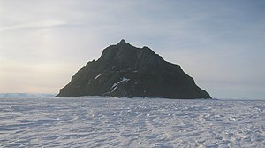
| Inaccessible Island from the southeast | ||
| Waters | Erebus Bay | |
| Archipelago | Dellbridge Islands | |
| Geographical location | 77 ° 39 ′ 30 ″ S , 166 ° 22 ′ 0 ″ E | |
|
|
||
| length | 1.5 km | |
| width | 500 m | |
| surface | 60 ha | |
| Highest elevation |
East Peak 160 m |
|
| Residents | uninhabited | |
|
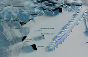
Dellbridge Islands satellite image . Inaccessible Island lower left. On the right the Erebus glacier tongue |
||
Inaccessible Island is a rocky island belonging to the Antarctic Dellbridge Islands in Erebus Bay on Ross Island . It is located about 1.6 km southwest of Cape Evans . It is the most impressive of the islands because at a height of up to 160 m it is almost always free of snow. It was discovered during the Discovery Expedition (1901-1904) led by Robert Falcon Scott . The island got its name because of the difficulty of reaching it ( English inaccessible , inaccessible).
Individual evidence
- ↑ geonames.usgs.gov . Inaccessible Island - Geographic Names Information System (GNIS). Retrieved January 17, 2018

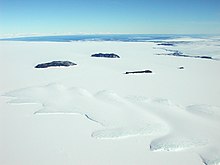
The Dellbridge Islands. Inaccessible Island in the upper center of the picture. In the foreground the Erebus glacier tongue , on the right Cape Evans. In the background the Ross Sea


