
Isla de Tierra Bomba
| Isla de Tierra Bomba | ||
|---|---|---|
| Waters | Caribbean Sea | |
| Geographical location | 10 ° 21 ′ 7 ″ N , 75 ° 34 ′ 6 ″ W | |
|
||
| length | 7 km | |
| width | 5.8 km | |
| surface | 19.84 km² | |
| Highest elevation | 20 m | |
| Residents | 9000 (2011) 454 inhabitants / km² |
|
 |
||

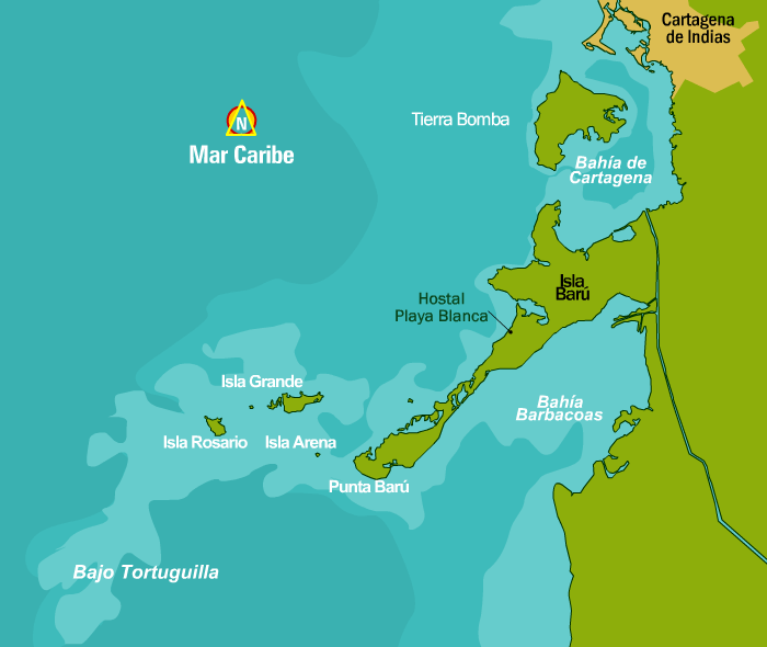
The Isla de Tierra Bomba is an island off Colombia's Caribbean coast . It closes the Bahía de Cartagena de Indias from the open sea. The Colombian city of Cartagena is located on the bay . The island belongs to the urban area. It has an area of 19.84 km² and about 9,000 inhabitants.
The places on the island are Tierra Bomba (northern tip), Punta Arenas (northeast coast), Caño del Loro (east coast) and Bocachica (south).