Jeta (Guinea-Bissau)
| Jeta | ||
|---|---|---|
| ILHA DE JATA in the northwest of the topographic map sheet | ||
| Waters | Atlantic Ocean | |
| Archipelago | Bissagos Archipelago | |
| Geographical location | 11 ° 53 ′ N , 16 ° 15 ′ W | |
|
|
||
| length | 17.5 km | |
| width | 14.8 km | |
| surface | 109 km² | |
| main place | Bagango | |
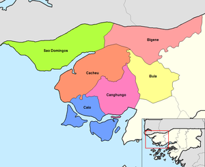
| Jeta belongs to the Caió administrative sector of the Cacheu region | ||
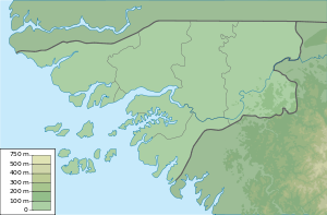
Jeta is an island that belongs to the West African country of Guinea-Bissau . It is located north of the Bissagos Archipelago just off the mainland coast and has an area of 109 square kilometers.
location
The island is 1500 meters west of the somewhat larger Ilha de Pecixe , in front of the mouth of the Rio Mansoa River in the Atlantic Ocean , and 1700 meters south of the mainland, separated by the Canal de Jata . Jeta is part of the Caió administrative sector in the Cacheu region .
In the south, the wide Canal do Gêba separates the Ilha Jeta and its neighboring island of Pecixe from the islands of the Bissagos Archipelago.
Individual evidence
- ↑ Ilha de Jeta, Guinea-Bissau - Geographical Names, map, geographic coordinates. Retrieved August 2, 2017 .
- ↑ Maplandia.com Team: Jeta Map | Guinea-Bissau Google Satellite Maps. Retrieved August 2, 2017 .


