Kühsteinfelsen
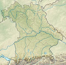
Along with other locations with the same name, the Kühstein is an ejection rock of the Ries impact in the municipality of Mönchsdeggingen in the Bavarian district of Donau-Ries . In addition to its position as an outstanding geotope, it is a registered natural monument.
Coordinates: 48 ° 46 ′ 22.8 " N , 10 ° 34 ′ 22.7" E
Mönchsdeggingen is home to two geotopes of the Ries National Geopark on the western outskirts . The striking rock massif, which is visible from afar from the Nördlinger Ries , is opened up on its western edge by a quarry, where a small rest area invites hikers and interested visitors to linger.
In the immediate vicinity on the other side of the road is the exposure of the near-shore river delta of the former Rieskrater-See, another geological outcrop of the Ries Geopark with a completely different geological structure.
Both geological outcrops are clearly signposted and explain the respective geological features. They are also stops on the geological educational trail 'Geotope Kühstein' with a length of around 3 km and a walking time of 1 to 1.5 hours. The Kühsteinfelsen has been designated as a valuable geotope by the Bavarian State Office for the Environment (geotope number: 779R008).
See also
Individual evidence
- ↑ Bavarian State Office for the Environment, Kühsteinfelsen SW von Mönchsdeggingen (accessed on October 7, 2017).

