Kangri Garpo
| Kangri Garpo | ||
|---|---|---|
| Highest peak | Ruoni ( 6882 m ) | |
| location | Tibet Autonomous Region ( PR China ) | |
| part of | Himalayas | |
|
|
||
| Coordinates | 29 ° 14 ' N , 96 ° 43' E | |
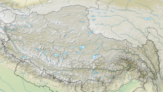
The Kangri Garpo is a mountain range about 280 kilometers long, extending from northwest to southeast in the autonomous region of Tibet on the border with India.
Located on the south-eastern edge of the Tibetan Plateau and directly adjacent to the eastern foothills of the Himalayas , it is framed by the Yarlung Zangpo (upper reaches of the Brahmaputra ) and three tributaries of the Yarlung Zangpo: in the west by the Yarlung Zangpo, in the north by the Parlung Zangpo , in the south from Kangri Garpo Qu and in the east from Sang Qu , which merges with Kangri Garpo Qu near Xia Zayu and is then called Lohit (Chinese: Zayu Qu).
Since there are no higher mountains south of Kangri Garpo that could represent an effective climate barrier , humid monsoon winds blowing from the southwest, coming from the Indian Ocean, reach Kangri Garpo and bring high rainfall, so that the mountain range is heavily glaciated, especially in the eastern part. According to measurements by the Chinese Academy of Sciences in 1973–1980, the total surface area of all glaciers in Kangri Garpo was around 1683 km² at that time. The largest glacier is the Lhagu Glacier with a length of thirty kilometers and a width of up to 2.5 kilometers.
Over thirty six-thousanders - all of the peaks have not yet been climbed (as of 2008) - are located in Kangri Garpo. The highest point is the Ruoni (also called Bairiga or Chombo) with 6882 m .
literature
- Tamotsu Nakamura: The Alps of Tibet . Detjen-Verlag, Hamburg 2008 ISBN 978-3-937597-25-6
Web links
- Kangri Garpo Range in Southeast Tibet in Japanese Alpine News , Vol. 1, October 2001 (PDF file; 121 kB)
