Karrat (island)
| Carrat | ||
|---|---|---|
| Waters | Karrat Fjord | |
| Geographical location | 71 ° 30 '17 " N , 53 ° 3' 28" W | |
|
|
||
| surface | 28.3 km² | |
| Residents | uninhabited | |
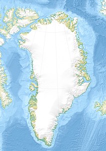
Karrat is an uninhabited island in the Uummannaq district of Avannaata Kommunia in Greenland . It is located in the Karrat Fjord , about 5 km southeast of Nuugaatsiaq .
geography
Karrat extends from its southwestern cape Oqqorleq 14.3 km to the northeastern cape Nuliarfiup Nuua and is therefore banana-shaped. The island can be divided into two parts: On the one hand, the main part with the mountain Karrat Qaqqaat , where east of it lies the Tasersuit lake area , which consists of two larger and many smaller lakes. The second part consists of the Karrat Nunaat peninsula , which is connected to the main part by the Qungasikassaa isthmus .
See also
Individual evidence
- ^ Names of the geographical features of Greenland from Asiaq , provided by Oqaasileriffik
