Kastoria lake
| Kastoria lake | ||
|---|---|---|

|
||
| Geographical location | West Macedonia , Greece | |
| Drain | to the Aliakmonas | |
| Data | ||
| Coordinates | 40 ° 30 ′ 54 ″ N , 21 ° 18 ′ 0 ″ E | |
|
|
||
| Altitude above sea level | 629 m | |
| surface | 28.7 km² | |
| length | 7.5 km | |
| width | 5.4 km | |
| Maximum depth | 8.5 m | |
| Middle deep | 4 m | |
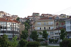
The Kastoria Lake ( Greek Λίμνη Καστοριάς Limni Kastorias , even Orestida Lake Λίμνη Ορεστίδος or Orestiada Lake Λίμνη Ορεστιάδος) is a natural lake in the region of Western Macedonia in Greece . It is located with its entire area in the municipality of Kastoria at an altitude of 629 m above sea level. The city of Kastoria is located directly on the eastern shore of the lake on a steeply rising peninsula.
The lake has a maximum length of about 7.5 km and a greatest width of 5.4 km. The mean depth is 4 m, the maximum 8.5 m. The area covered by Lake Kastoria measures 28.7 km², resulting in a water volume of 120 million cubic meters. The lake is fed from the surrounding mountains. The water catchment area amounts to 304 km². The drain is to the Aliakmonas . The water renewal time of Lake Kastoria is 2.3 years. The average temperature of the lake is 15 ° C, the maximum temperature of the lake was determined to be 22 ° C.


