Katif (Israeli settlement)
| Catif | ||
|---|---|---|
| Basic data | ||
| State : |
|
|
| Coordinates : | 31 ° 23 ′ N , 34 ° 19 ′ E | |
| Residents : | 394 (2004) | |
| Time zone : | UTC + 2 | |
| Community type: | Moshav | |
|
|
||
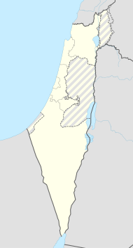
Katif ( Hebrew קטיף) was a Jewish settlement in Gush Katif ("Katif Block") in the Gaza Strip . It was an agricultural settlement in the shape of a moshav . Katif was about a kilometer north of the Palestinian refugee camp Dir al-Balah .
history
Katif was founded in 1973 as a paramilitary settlement of the Nachal (No'ar Chalutzi Lochem - Fighting Pioneer Youth) and was handed over to a civil administration in 1977. This made Katif the first Jewish settlement in the Gaza Strip after the Six Day War of 1967. It belonged to the regional administration of Hof Aza.
The residents of Katif were Orthodox Jews and belonged to the Bne Akiwa organization .
The moshav's economy was based on a plastics factory, fabric factory, and agriculture, including a dairy farm.
In 2005 about 70 families or 330 people lived in Katif, including 220 children. The settlement's religious elementary school and high school also served the other settlements in the region.
As part of Israel's withdrawal from the Gaza Strip , Katif and the other 20 Jewish settlements in the Gaza Strip were evacuated in August 2005. In protest against the evacuation by the Israeli army , around 80 families set fire to the entrance to their settlement on the day of the evacuation (August 21) by setting car tires and rubbish containers on fire.
After the evacuation of the residents, the houses were demolished and the land was given to the Palestinians.
Demographics
The population of Katif was:
| year | 1999 | 2000 | 2001 | 2002 | 2003 | 2004 |
|---|---|---|---|---|---|---|
| Residents | 296 | 317 | 329 | 338 | 369 | 394 |
See also
Web links
- katif.net (Hebrew)
- english.katif.net (english)
Individual evidence
- ↑ yesha.israel.googlepages.com (English) accessed on November 25, 2009.
