Kiantajärvi
| Kiantajärvi | ||
|---|---|---|

|
||
| Geographical location | Suomussalmi municipality in Kainuu ( Finland ) | |
| Drain | Emäjoki → Kiehimänjoki → Oulujoki | |
| Places on the shore | Suomussalmi | |
| Data | ||
| Coordinates | 65 ° 3 ' N , 29 ° 8' E | |
|
|
||
| Altitude above sea level | 199.3 m | |
| surface | 187.93 km² | |
| length | 45 km | |
| volume | 1.385 km³ | |
| Maximum depth | 43 m | |
| Middle deep | 7.37 m | |
| Catchment area | 3428 km² | |
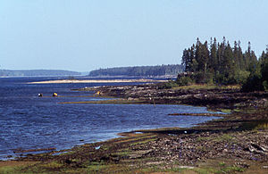
The Kiantajärvi is a lake in the Finnish landscape of Kainuu .
The lake is located in the municipality of Suomussalmi and extends to a few kilometers from the Russian border.
The lake has a water surface of 191.15 km² and a length of 45 km. The height of the water level above sea level fluctuates between 195.5 and 199.5 m. The runoff has been regulated since 1959. In Suomussalmi , the administrative center of the municipality of the same name, on the south bank of the lake there is a hydroelectric power station. The water of the Kiantajärvi flows over the Emäjoki to the Iijärvi , and on over the Kiehimänjoki to the Oulujärvi and finally over the Oulujoki to the Gulf of Bothnia .
