Klidhes Islands
Coordinates: 35 ° 42 ′ 22 ″ N , 34 ° 36 ′ 11 ″ E
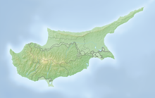
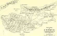
The Klidhes Islands (Greek Κλείδες , Turkish Kilit Adalari ) are a series of small rocky islands on the northeastern tip of Cyprus , Cape Apostolos Andreas in the Famagusta district .
geography
The main island of the group extends elongated tapering over about 750 m in a southwest to northeast orientation. It has a maximum width of 150 m and a height of 17 m . The archipelago is of volcanic origin and rich in mineral resources such as copper ore. It represents both the northernmost and easternmost point of Cyprus. Natural gas is suspected to be present in the upstream waters.
history
A lighthouse has been located on the largest of the Klidhes Islands since 1913.
They have been administered by the internationally unrecognized Turkish Republic of Northern Cyprus since 1974 .
fauna and Flora
The archipelago is uninhabited and a breeding area of the formerly endangered coral gull , which today has a stable population of around 15,000 breeding pairs. The vegetation consists of low maquis .
Individual evidence
- ↑ https://www.ibiblio.org/lighthouse/cypn.htm
- ^ Wayne J. Fuller: Bird Watching. In: north cyprus tourism.de. Retrieved July 19, 2019 .


