Klinghardt Mountains
| Klinghardt Mountains | ||
|---|---|---|
|
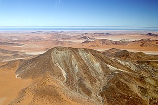
Klinghardt Mountains. In the foreground the highest |
||
| Highest peak | Highest ( 1070 m ) | |
| location | ǁKaras , Namibia | |
|
|
||
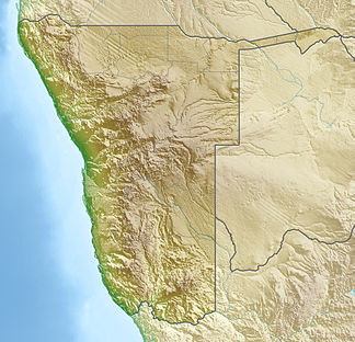
| Coordinates | 27 ° 18 ′ S , 15 ° 49 ′ E | |
| surface | 350 km² | |
The Klinghardtberge are a Namibian mountain range in the diamond restricted area . The Klinghardtberge are around 90 km southeast of Lüderitz and extend over an area of around 350 km². The highest is located in the east of the Klinghardtberge .
The mountains are named after Georg Klinghardt who, as an employee of the German Colonial Society and prospector, mapped the area around 1909.
Web links
Commons : Klinghardberge - Collection of pictures, videos and audio files
Individual evidence
- ↑ Namibia Travel Map . Kunth-Verlag, Munich 2017, ISBN 978-3-95504-578-4 .
- ↑ See the old map of the restricted area issued in Kolmannskuppe
- ↑ Klinghartberge Mapcarta.Retrieved on May 12, 2018
- ↑ Highest Mapcarta. Retrieved May 19, 2018
- ↑ Pat Honeyborne: Adventure, Haunted, and Diamonds. Kuiseb publishing house. 2005. ISBN 3-936858-82-9 . Chapter: Oranjemund and the restricted area .

