Ko Phi Phi
| Ko Phi Phi | ||
|---|---|---|
| Waters | Andaman Sea | |
| Geographical location | 7 ° 44 ' N , 98 ° 46' E | |
|
|
||
| Number of islands | 6th | |
| Main island | Ko Phi Phi Don | |
| Map sketch | ||
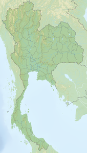
Ko Phi Phi ( Thai เกาะ พี พี = Phi Phi Islands ) is an archipelago (Mu Ko - หมู่ เกาะ ) in the Andaman Sea off the west coast of southern Thailand - consisting of the main island Phi Phi Don ( พี พี ดอน ) and the smaller side island Phi Phi Le ( พี พี เล ).
In the north are the smaller Ko Mai Phai ( bamboo island , เกาะ ไม้ไผ่ ) and Ko Yung ( mosquito island , เกาะ ยุง ), which are only inhabited by a few fishermen. In the south are the inaccessible rocky Ko Bida Nai ( เกาะ บิ ด็ะ ใน ) and Ko Bida Nok ( เกาะ บิ ด็ะ นอก ). They are very popular with divers because of the biodiversity of the surrounding coral reefs and steep walls - which reach up to 24 meters in depth.
Together they form the 390 km² Hat Noppharat Thara Marine National Park ( อุทยานแห่งชาติ หาด นพรัตน์ ธารา ) in Amphoe Mueang , Krabi Province and offer an ideal environment for water and diving activities against the backdrop of towering rock formations that have been bizarre by the forces of nature. But tourism, including many day visitors, threatens the sensitive ecological structure of the islands that are too small for mass visits.
gallery
The isthmus of Ko Phi Phi Don (2006)
Web links
Individual evidence


