
Rosenheim trunk basin bogs
|
Rosenheim trunk basin bogs
|
||
 Koller felts |
||
| location | ||
| Geographical location | 47 ° 48 ' N , 12 ° 3' E | |
|
||
| Setup date | 2005 | |

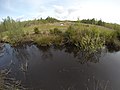
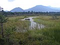
Today's Rosenheim trunk basin bogs denote an area between Rosenheim in the north and the edge of the Alps in the south.
This area with its numerous raised bogs was created by the silting up of the former Rosenheimer See , which had formed after the retreat of the Inn glacier and was filled with meltwater in the post-ice age. A swamp landscape formed from the clay-rich seabed that remained.
In the 19th century, humans began to drain the area and use it economically by extracting peat . Only a small remnant of the original marshland remains in the Sterntaler Filzen . Use in the peripheral areas has also intensified and has displaced traditionally cultivated orchards .
Despite these changes, the area is of high ecological value and is therefore now protected several times, with the protected areas partially overlapping. These include Fauna-Flora-Habitat , LIFE + and Bayern-Netz-Natur .
gallery

Hochrunstfilze
Eulenauer felt
Hubersee in the Sterntaler Filzen


