Kopalnia Węgla Kamiennego Jankowice
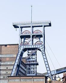
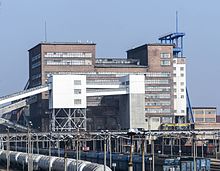
The Jankowice mine (Polish Kopalnia Węgla Kamiennego Jankowice ; former name Blücherschächte ) is an active hard coal mine in the southeast of Rybnik , Poland.
The mine has belonged to Polska Grupa Górnicza since May 1, 2016 and in 2014 it was in the red with a deficit of 35.00 zł per ton of hard coal mined. It lost its independence on July 1, 2016 and was incorporated as an enterprise into the newly created ROW mine (Rybniki Okręk Węglowa).
history
In 1897 Guido Henckel von Donnersmarck bought land in the villages of Boguszowice, Chwałowice and Jankowice. a. with the aim of mining coal there. One of the pits dedicated to this goal was the Blücherschächte .
The sinking of Shaft I of the Blücher mine with a diameter of 6.6 m on the western edge of the Judas Forest began in 1913 and had to be interrupted at 40 m depth due to strong water inflows. It was only with the help of the freezing process that it was possible to penetrate deeper. In April 1916, the 165 m level was set in order to mine seams 503 to 507 from there. Shaft II, the digging of which had also started in 1913 and which was 100 m away from Shaft II, also reached the coal mountains in 1916.
The first ton of coal was unearthed on June 21, 1916 and on this occasion the mine was named Blücherschächte. Initially, 350 miners worked on it, who mined 14,000 tons of coal annually.
When Upper Silesia was partitioned in 1922, the mine remained in the possession of the Henckel von Donnersmarck family (based in London; general administration in Tarnowice); however, the name was Polonized in Szyby Blüchera . In 1932, the district administrator applied for the facility to be renamed General Pulaski, but was unable to enforce it. In 1934 it was renamed Jankowice , but this was reversed during the German occupation from 1939 to 1945.
As a result of the global economic crisis, the mine was closed from 1936 to 1938 despite numerous protests. Production started up again immediately after the occupation of Upper Silesia by German troops, but because of the lack of young miners, Soviet prisoners of war were employed as forced labor.
In 1945 the mine was nationalized and, like all other facilities in the area, was managed by the Rybnickie Union for the Coal Industry from 1945 to 1982. Since 2003 the mine has belonged to Kompalnia Węglowa SA.
Due to the increased energy consumption in Poland in the 1970s, Rybnickie Zjednoczenie Przemysłu Węglowego decided to open up the seams in the Marklowicka basin of the mine with a new shaft system with shafts V, Va and VI. This mine was in operation for 30 years and at times employed 3,000 miners. However, it has now been shut down in three steps (November 16, 2000: liquidation shaft V; April 7, 2003: shaft Va and May 22, 2007: shaft VI) and all daytime facilities demolished.
The old system to the east with the three shafts (Doppelbock II, 436 m deep, rope travel and pulling-in weather shaft; concrete tower VII 471 m deep, 2 skips with 25 t load capacity each and 8 m / s speed; concrete tower VIII, 732 m deep, shaft diameter 8 , 5 m, extraction) as well as two individually located weather shafts (III south of the main facility, 421 m deep; IV east, 273 m deep) produces 12,000 t of coal daily with 3700 employees (as of 2011).
The mine’s greatest disaster occurred on May 4, 1950, when 29 miners were killed in a methane and coal dust explosion.
Funding figures
Production in 1938: 265,300 t; 1970: 1.98 million t; 1979: 3.52 million t
Remarks
- ↑ To compare the sales figures of the KWSA Group in 2014, see Kompania Węglowa - 12 z 15 kopalń na minusie , accessed on November 19, 2015.
swell
- Jerzy Jaros. Słownik historyczny kopalń węgla na ziemiach polskich . Śląski Instytut Naukowy, Katowice 1984. ISBN 83-00-00648-6 .
- Yearbook for the Upper Mining District Wroclaw . Phoenix Publishing House. Katowice, Breslau, Berlin. 1913. Digitized version at http://www.dbc.wroc.pl/dlibra/publication?id=3349&tab=3 before (last accessed on May 5, 2015)
- Kurt Koenig. Coal mining in Upper Silesia from 1945–1955. Scientific contributions to the history and regional studies of Eastern Central Europe. Published by the Johann Gottfried Herder Institute. Marburg 1958.
Web links
- Friends of the mine run an informative Internet presentation of the mine at http://jankowice.net/ . This article owes several important details to this page. There is also a picture gallery of the mine.
- The KWSA's Polish-language website http://www.kwsa.pl/o_firmie/oddzialy/Oddział+KWK+ “ Jankowice” contains the latest information from the operator about the mine.
- see also the Polish Wikipedia page of the mine under pl: Kopalnia Węgla Kamiennego Jankowice
Coordinates: 50 ° 2 ′ 50.9 ″ N , 18 ° 35 ′ 13 ″ E


