Lago Presidente Ríos
| Lago Presidente Ríos | ||
|---|---|---|

|
||
| The Lago Presidente Ríos on the Taitao Peninsula (lower left corner) | ||
| Geographical location |
Region XI Chile |
|
| Data | ||
| Coordinates | 46 ° 28 ′ S , 74 ° 25 ′ W | |
|
|
||
| Altitude above sea level | 60 m | |
| surface | 312 km² | |
| length | 40 km | |
| width | 40 km | |
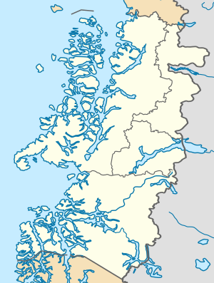
The Presidente Ríos Lake is a lake in the south of Chile , which is on the Taitao Peninsula in the Region XI is. It is located in the Laguna San Rafael National Park . The lake is named after Juan Antonio Ríos Morales , who was President of Chile from 1942 to 1946 .
The lake, located 60 m above sea level , has a surface area of 312 (or 313) km², a maximum length of 40 km and a maximum width of also 40 km.
Web links
Commons : Lago Presidente Ríos - Collection of images, videos and audio files
Individual evidence
- ↑ Política Nacional para los Recursos Hídricos 2015. (PDF; 4.7 MB, p. 27 (26)) www.interior.gob.cl, accessed on May 24, 2015 (Spanish).
- ↑ The inland waters of Latin America ... www.fao.org, accessed on May 24, 2015 .
