Lake Brugneto
| Lake Brugneto | ||
|---|---|---|

|
||
| Geographical location | Liguria , Italy | |
| Tributaries | Brugneto | |
| Drain | Artificial canal | |
| Location close to the shore | Torriglia , Propata and Rondanina | |
| Data | ||
| Coordinates | 44 ° 32 '22 " N , 9 ° 11' 31" E | |
|
|
||
| Altitude above sea level | 777 m slm | |
| surface | 97 ha | |
| length | 3 km | |
| width | 200 m | |
| volume | 25,130,000 m³ | |
| scope | 13.5 km | |
| Maximum depth | 70 m | |
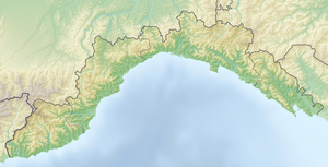
The Lago del Brugneto (in German: Brugnetosee ) is a reservoir in the Italian region of Liguria . It is located in the Ligurian Apennines within the Antola Nature Park . Located in Alta Val Trebbia , near the municipalities of Torriglia , Propata and Rondanina , the lake represents the largest freshwater surface in the region.
The artificial basin of the lake was created in 1959 by the Azienda Municipalizzata Gas e Acqua di Genova and flooded by the damming of the Brugneto River . The lake is located at a height of 777 meters above sea level and, with its maximum capacity of 25.13 million cubic meters of fresh water, represents the main water supply of the regional capital Genoa .
The length of the reservoir is three kilometers with a width of around 200 meters. The circumference is approximately 13.5 kilometers.
