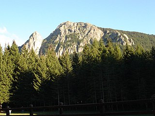
Ligurian Apennines
| Ligurian Apennines | ||
|---|---|---|
| Highest peak | Monte Maggiorasca ( 1803 m slm ) | |
| location | Piedmont / Liguria border , Italy | |
|
|
||
| Coordinates | 44 ° 33 ' N , 9 ° 29' E | |
The Ligurian Apennines is the northwestern end of the Apennines in Italy . Its ridge forms the eastern part of the border between Liguria in the south and Piedmont in the north. West of the Colle di Cadibona (436 m) (near Savona ) he goes to the Western Alps belonging Alps Ligurian about. The Monte Maggiorasca , about 85 km to the east, is the highest point in the Ligurian Apennines at 1,803 m.
mountains
The highest peaks in the Ligurian Apennines include:
- Monte Maggiorasca (1803 m)
- Monte Bue (1776 m)
- Monte Penna (1735 m)
- Monte Lesima (1724 m)
- Monte Ragola (1711 m)
- Monte Aiona (1701 m)
- Monte Ebro (1701 m)
- Monte Chiappo (1699 m)
- Monte Cavalmurone (1670 m)
- Monte Roncalla (1656 m)
- Monte Alfeo (1651 m)
- Monte Carmo (1641 m)
- Monte Gottero (1639 m)
- Monte Antola (1597 m)
- Monte Molinatico (1549 m)
- Monte Oramara (1522 m)
- Monte Zuccone (1423 m)
- Monte Zatta (1404 m)
- Monte Buio (1401 m)
- Monte Ramaceto (1345 m)
- Monte Collere (1289 m)
- Monte Beigua (1287 m)
- Monte delle Figne (1172 m)

