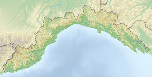
Monte delle Figne
| Monte delle Figne | ||
|---|---|---|
|
View from the Piani di Praglia to the Monte delle Figne |
||
| height | 1172 m slm | |
| location | Border metropolitan city of Genoa / Province of Alessandria , Italy | |
| Mountains | Ligurian Apennines | |
| Coordinates | 44 ° 33 '51 " N , 8 ° 50' 8" E | |
|
|
||
The Monte delle Figne is a 1172 meter high mountain in the northern Italian Apennine mountain range . It is located on the side of the Apennines facing the Po plain , not far from the Ligurian-Padan watershed of Monte Taccone . The summit of Monte delle Figne is the highest point around the Parco Regionale delle Capanne di Marcarolo and lies on the border between the metropolitan city of Genoa and the province of Alessandria .

